Labels

Aberdeenshire (21) Angus (4) antiquities (87) Argyll and Bute (35) Arran (7) art (37) birds (231) bridge (9) Caithness (12) Carmarthenshire (5) castle (165) Ceredigion (9) Channel Islands (13) Cheshire West and Cheshire (1) City and County of Swansea (1) City of Bristol (2) City of Edinburgh (4) Conwy (8) Cornwall (74) County Antrim (19) County Down (23) County Durham (3) County Londonderry (4) Cumbria (19) Denbighshire (2) Devon (48) diving (7) Dorset (18) Dumfries and Galloway (22) Dundee City (2) East Lothian (6) East Sussex (16) East Yorkshire (6) English Riviera (3) Essex (17) Fife (19) Flintshire (1) food (13) fossils (14) gardens (28) Ghosts (35) Glamorgan (1) Gower (7) Guernsey (4) Gwent (1) Gwynedd (19) Hampshire (13) Highland (72) Inner Hebrides (42) Inverclyde (5) Islay (8) Isle of Anglesey (14) Isle Of Man (7) Isle Of Wight (10) Isles of Scilly (3) Jersey (7) Kent (22) Lancashire (8) Lewis and Harris (7) lighthouse (62) Lincolnshire (8) Merseyside (8) Mid Glamorgan (1) mining (23) Moray (10) Mull (8) Norfolk (21) North Ayrshire (13) North Yorkshire (12) Northern Ireland (45) Northumberland (17) Orkney (10) Outer Hebrides (14) Pembrokeshire (27) pubs (47) Ross and Cromarty (20) Scotland (300) Scottish Borders (3) Shetland (14) shipwrecks (42) Skye (12) smuggling (48) Somerset (9) South Ayrshire (6) South Glamorgan (5) South Gloucestershire (1) Suffolk (18) surfing (83) Sutherland (16) Tyne and Wear (10) Wales (93) wartime (75) webcams (232) West Dunbartonshire (3) West Glamorgan (9) West Sussex (9)

Friday 30 December 2011

PETERHEAD

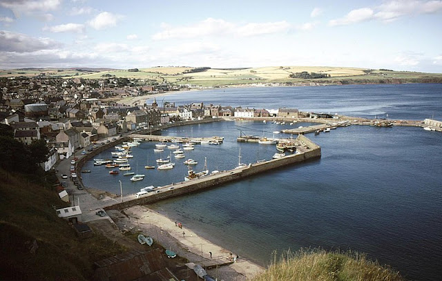
Peterhead brought little joy to James Francis Edward Stuart, son of the deposed James II of England, and commonly referred to as "The Old Pretender" for his designs on the throne, when he arrived there from France on 22 December 1715, the year of "The Fifteen" Jacobite Rising which was aimed at putting James on the throne. He arrived stricken with seasickness and fever and in a state of misery over the fact that his treasure ship had been lost en route. To add to his woes, there was a rather feeble show of support waiting there for him. He didn't hang about: in February the following year he boarded a ship at Montrose for his return to France.

Peterhead has the distinction of being the most easterly point of Scotland, as well as the most populous town in Aberdeenshire; Aberdeen itself comes under a different municipal area. Fishing is the name of the game here, operating out of a complex, multi-section harbour, although further back in time sealing and whaling played a part in the local economy. The town is often referred to as "The Blue Toon", probably because of the colour of the socks and jumpers traditionally favoured by the fishermen. Peterhead's tourist attractions include the Lido, which is actually a sandy beach within the town's outer harbour. Peterhead Old Parish Church, or "Muckle Kirk", is 200 years old and has a graceful spire. Each summer, the town holds its Scottish Week, a chance to showcase the best produce and entertainment the locality can offer.

Map of the area.

Peterhead Bay - geograph.org.uk - 159768. Photo by Richard Slessor, via Wikimedia Commons.


Wednesday 28 December 2011

BODDAM

Boddam, a granite fishing village which almost vies with Peterhead for the title of most easterly place in Scotland, lies above a harbour with big, solid concrete walls. The village is dominated by the red and white lighthouse on nearby Buchan Ness, completed in 1827 by Robert Stevenson, the grandfather of writer Robert Louis Stevenson. A bridge connects the lighthouse to the mainland. A public footpath from the harbour leads to the golden Sandford Bay, where lovers of sea bass can try their luck with these fish, as they are attracted to the area by the warm water brought about by the proximity of Peterhead Power Station. The Bay is also a great place for a walk, perhaps with a dog in tow, who will no doubt become all the more excitable due to the large rabbit population on this shore. Wildlife enthusiasts can view the large numbers of seals on the rocks outside the harbour, as well as a variety of seabirds. There used to be an RAF station nearby called RAF Buchan station, but this was closed down after 52 years. Now there is a bronze statue in Boddam of an airman which was unveiled in 2009 to commemorate the station. Sadly, the year after the unveiling, the local press reported that the statue had been vandalised by so-called "freedom fighters".

Map of the area.

Boddam. Photo by Mike Pennington, via Wikimedia Commons.


Monday 26 December 2011

CRUDEN BAY

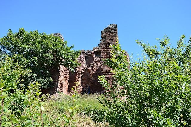
This beautiful bay, overlooked by the haunting ruins of the 16th century Slains Castle, was frequented by the novelist and creator of Dracula Bram Stoker, in fact it is thought that Slains Castle was the inspiration for Dracula, which was written in 1895. Two years later, the railway reached this area, opening the area up to tourism. A magnificent hotel was built, and golf courses were laid out, bordering on the fabulous sandy beach. A 1931 report of a serious fire at the railway station described it as having "commodious refreshment rooms, booking office, entrance hall and waiting rooms". The railway and hotel have gone now, but other hotels have been built, and the Cruden Bay Golf Club remains, billing itself as "a unique and unforgettable experience". As for the castle, it was announced in 2007 that the castle was to be converted into apartments, but this project is currently in the balance. Anyone wanting to visit the castle is warned to take care because of the dangerous surroundings, in fact as if to reinforce the dangers, it was reported earlier this month that a pensioner had gone missing in the area of the path from Cruden Bay to Slains Castle.

In 1914 Cruden Bay was the starting point for the first ever flight across the North Sea, when the Norwegian pilot Tryggve Gran flew from here to Stavanger. There is a memorial to him in the main street. St James Church dates from the 18th century, but there is a font which probably came from an earlier church built by Malcolm II in 1012, after a battle between the Scots and the Danes.

Map of the area.

View of Cruden Bay from the estuary. Photo by Mikey Shepherd, via Wikimedia Commons.


Sunday 25 December 2011

COLLIESTON

The village of Collieston, 20 miles north of Aberdeen, was once a thriving fishing village, with a good dose of smuggling thrown in for good measure. The 19th century pier stands as a reminder of past fishing activities. Sadly, the fishing declined partly as a result of the effect of the pier on the harbour, causing an accumulation of sand there. To the south of the village is the Forvie National Nature Reserve where the remains of a 12th century church lie half-buried among the sand dunes, whose inhabitants include the eider ducks so prevalent in this north-east corner of the country. Stories about smuggling and other tales of Collieston over the ages can be found on the excellent Collieston website.

Map of the area.

Lobster Boats at Collieston. - geograph.org.uk - 117085. Photo by Colin Smith, via Wikimedia Commons.


Thursday 22 December 2011

ABERDEEN

From Newtonhill, the approach to Aberdeen is marked by a series of small villages: Downies, Portlethen, which has become a residential area for commuters to Aberdeen, and Findon (aka Finnan), home of a variety of smoked fish called Finnan Haddie.

James Boswell and Samuel Johnson, who we last met slagging off a waiter at their inn in Montrose (see 8 December) had a much more positive experience on their arrival at Aberdeen, where the Lord Provost invited them to the Town Hall and bestowed on Johnson the freedom of the city. They also visited the English Chapel, where "the congregation was numerous and splendid".

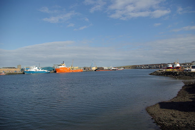
The modern-day Aberdeen is dominated by the North Sea oil industry, as can be seen from the many oil-platform supply vessels crowding the harbour. The harbour's other functions include fishing, fish-processing and general trading, and it is also a departure point for ferries to Shetland and the Orkneys. Aberdeen's sandy shore has an 18-hole golf course called the Kings Links running alongside it. The city's museums include a Maritime Museum, housed in Provost Ross's House on the historic street known as Shiprow, an art gallery and Provost Skene's House, which resembles a castle more than a mere house. Aberdeen is often referred to as the Granite City, since granite features heavily in the city's impressive architecture, for example in the Marischal College, founded in 1593, which forms part of the University and has a museum which tells the story of the college's history. In fact, this learned city has two universities: the University of Aberdeen and Robert Gordon University, though the latter has only had university status since 1992.

The part of the city known as Old Aberdeen was once a separate Burgh and from the late Middle Ages was an important political, ecclesiastical and cultural centre. Many of the old buildings in this part of the city form part of a conservation area. King's College, which used to be a separate university, is located here. Its chapel dates from the 15th century, and has an impressive tower topped with an "imperial crown", a recreation of the original 17th century crown, which was lost during a storm. St Machar's Cathedral is also in Old Aberdeen; in spite of its name it is strictly speaking a "high kirk", since it is no longer the seat of a bishop.

For a list of events in Aberdeen, see here.

Webcam view of Aberdeen Beach.

Map of the area.

Old Marine Operations Centre, Aberdeen - geograph.org.uk - 1958623. Photo by Greig Ritchie, via Wikimedia Commons.


Tuesday 20 December 2011

MUCHALLS

It's been a while since I last told a ghost story, so as we come to the darkest part of the year it seems like a good time for another one. The story behind the Green Lady of Muchalls Castle is a very sad one so get the tissues ready. The area was rife with smuggling in the old days, and the castle had a tunnel leading down to a cave on Muchalls Beach which was used to store spirits and wine brought in by smugglers. A young woman from the castle was having a bit of a romance with one of the smugglers, and one day she ran down to the tunnel to greet his return, forgetting that it was high tide and the tunnel was prone to flooding at high tide. The poor lady drowned before she had a chance to keep her tryst, and her ghost is said to haunt the castle's drawing room, where she parades up and down with a brush in her hand, getting herself ready for the rendezvous that would never be.

There is much more to Muchalls Castle's past than smuggling. One of the most notable events in its history was in 1638 when a gathering of Covenanters (Scottish Presbyterians) took place here in the run up to the English Civil War. During Victorian times, Muchalls was a popular health resort, with a golf course and a railway station, now gone although the line still runs through here. One of its most distinguished visitors was Charles Dickens, who sang its praises as a beautiful place to visit. Robert Burns was moved to describe the area as "a good deal romantic", and not without reason, as the coast around here is a spectacular mix of soaring cliffs formed from pre-Cambrian rock, sea stacks and rugged headlands such as Grim Brigs and Doonie Point.

A short distance up the coast from Muchalls is the larger settlement of Newtonhill, a clifftop fishing village with cottages and fishermen's huts. The Burn of Elsick flows into the North Sea here, and there is much good walking in the area, such as circular walk which takes in a plank bridge over the Burn. The Braehead is a good place for walkers to rest and enjoy the views of the bay or watch out for the wildlife of the area which, as well as a variety of sea birds, includes occasional sightings of seals, dolphins or even whales.

Map of the area.

Felsite rocks Muchalls - geograph.org.uk - 375747. Photo by Russell Lett, via Wikimedia Commons.


Sunday 18 December 2011

STONEHAVEN

With Hogmanay coming up soon, Stonehaven is gearing up for its annual Stonehaven Fireballs ceremony. This festival is a spectacular and colourful way of seeing in the New Year which attracts thousands of spectators including a fair few 'expats' home for the holidays visiting friends and relatives. The main event is a parade of people along the High Street in the Old Town swinging fireballs around their heads.

The harbour of the old town of Stonehaven is shared by yachts and fishing boats, while the town itself centres around its 19th century Market Buildings. In 1748 a group of ministers imprisoned in the town secretly baptised the children of fishermen's wives, who brought their charges to the ministers' cell windows. This and other fascinating stories are told in the Tolbooth Museum, set in Stonehaven's oldest building, built in the 16th century as a storehouse for George the 5th Earl Marischal while Dunnottar Castle was being rebuilt. To the north of the town is the old royal burgh of Cowie, another fishing area, and a row of cottages calld Boatie Row. From here a path leads over the cliff to the ruined 13th century St Mary of the Storms Church, from where there are lovely sea views.

For a list of events in Stonehaven, follow this link.

Map of the area.

Stonehaven Harbour - geograph.org.uk - 2240451. Photo by Russel Wills, via Wikimedia Commons.


Saturday 17 December 2011

DUNNOTTAR CASTLE

The red cliffs that make such a magnificent contribution to the setting of villages such as Catterline present an even more impressive sight on reaching the approach towards Stonehaven, as the romantic ruins of Dunnottar Castle come into view. The castle must have been a highly effective fortress in its day, standing as it does on an impregnable rock separated from the mainland by a deep ravine. However, this does not mean that it cannot be visited, as there is a tunnel entrance leading up to the top level where the surviving buildings are sited. The castle's origins lie in the arrival of St Ninian in the 5th century, when he chose the site for one of a chain of churches. Over the years that followed, it saw plenty of action. In the Middle Ages William Wallace - aka Mel Gibson - led his Scottish Army in the defeat of the English, subsequently imprisoning and burning them in the castle church. In 1650, during an eight-month siege by Oliver Cromwell's army, a small garrison at the castle manfully held out and saved the Scottish Crown Jewels from destruction by allowing them to be smuggled out. The castle was seized by the Government following the 1715 Jacobite Rising because one of the participants in the Rising was the last Earl Marischal, the owner of the castle at the time. Two centuries of neglect followed until 1925, when the 1st Viscountess Cowdray began restoration work. So we have the Viscountess to thank for the fact that this incredible place can be revisited here in the 21st century.

Map of the area.

Dunnottar Castle - geograph.org.uk - 1550283. Photo by Alan Findlay, via Wikimedia Commons.


Wednesday 14 December 2011

CATTERLINE AND CRAWTON

A glance at the Catterline website reveals that the Christmas celebrations are in full swing in this little village on the east coast of Scotland. The local pub is holding a Christmas party for the residents on Friday, to which they are invited to wear black tie and best frocks, while two days later the church is putting on music and words accompanied by mulled wine and mince pies. Wish you were there? I do.

Catterline is perched on top of a cliff. It has a long history of fishing and smuggling activities, and acquired a pier in 1810 for the protection of the fishing vessels based there. Neighbouring Crawton also had a thriving fishing industry, but the boats moved from there to safer facilities at Stonehaven. There is a path linking the two villages. Also, from Crawton, birdwatchers should take the path to nearby Fowlsheugh RSPB Reserve, where huge numbers of kittiwakes, fulmars, razorbills, guillemots and other birds share this prime bit of sea-bird real estate.

Christianity arrived in the area around the year 400 when St Ninian came and converted the Picts, but the present incarnation of Catterline's church, St Philip's, only dates from 1848, though somehow it looks older. Its interior, with its whitewashed walls, has a bright, airy feel to it. Like many little coastal communities around the country, the village has proved a magnet for artists, and belongs to that select club with a "school" named after them. The "Catterline School" of artists, which came about during the 1950s, included Joan Eardley, who owned a cottage in the village, and whose works include "The Wave", painted outside during stormy weather in February 1961: that shows dedication!

Webcam view of Catterline Bay.

Map of the area.

View of Catterline Pier and Catterline Bay - geograph.org.uk - 1493683. Photo by Alan Morrison, via Wikimedia Commons.


Monday 12 December 2011

GOURDON AND INVERBERVIE

Just to the south of Inverbervie, the village of Gourdon has a long history of fishing possibly stretching back to Neolithic times. The harbour was no more than a gap in the rocks until 1819 when Thomas Telford built a proper harbour, later expanded. Inverbervie was granted the status of Royal Burgh by King David II when he and his Queen were forced to land here in 1341 during stormy weather on their way back from France, and the locals looked after them in their hour of need. The town takes its name from the River Bervie, which flows into the North Sea here. Fishing used to be the mainstay of the economy until a flax mill was opened, leading to a thriving textiles industry. One of the town's more notable sons was Hercules Linton, who designed the Cutty Sark tea clipper. He is remembered through a commemorative garden with a monument consisting of a full-size replica of the ship's figurehead. Linton is buried in the local church graveyard. Hallgreen Castle, overlooking the seafront, is now a private home offering tourist accommodation.

Map of the area.

Bervie Bay, Inverbervie - geograph.org.uk - 2139158. Photo by Dona Robbins, via Wikimedia Commons.


Sunday 11 December 2011

ST CYRUS AND JOHNSHAVEN

The small community of St Cyrus, just north of Montrose and at the southern extreme of the Aberdeenshire coast, is best known for its beautiful 3-mile beach and its National Nature Reserve, where in summer a host of butterflies can be found flitting among the flora here, which includes the purple clustered bellflower. Hovering above this lovely scene are the peregrine falcons which stalk the skies, ready to home in on their prey.

In the 18th century, Johnshaven was one of the most important fishing communities in Scotland. However, many of the young men at that time were being whisked away by the navy press gangs, leaving a shortage of manpower. Johnshaven's role as a fishing village is celebrated each year with a Fish Festival, held during the first half of August. The exact date depends on the tides. One of the big draws nowadays is the lobster fishing. The unfortunate lobsters can often be seen in water tanks by the harbourside, where they are kept before being exported to the Continent. Nearby, the Mill of Benholm is a restored, working water-powered meal mill which can be visited in summer. Also at Benholm is Benholm Church, on a site dating from at least the 13th century.

Map of the area.

Johnshaven Harbour - geograph.org.uk - 1832561. Photo by JThomas, via Wikimedia Commons.


Thursday 8 December 2011

MONTROSE

On August 20 1773 the famous 18th century travelling companions James Boswell and Dr Samuel Johnson fetched up in Montrose during a tour of Scotland. They were none too impressed with their lodgings there, an inn where according to Boswell a waiter "put a lump of sugar with his fingers into Dr. Johnson's lemonade, for which he called him "rascal!"." However, the following morning they started to see the town in a better light, visiting the town hall "where is a good dancing room, and other rooms for tea-drinking". [i]

The Montrose Boswell and Johnson visited in 1773 would have been a very different place to the present-day Montrose. There would have been no Montrose Academy in those days, with its handsome golden dome - the Academy was established in 1815. Neither would they have been able to visit the Montrose Museum, opened in 1842 and housed in an elegant building in the neo-classical style with Ionic columns on either side of the doorway. The present-day Montrose Parish Church would not yet have been built; instead Boswell and Johnson would have looked upon its predecessor, a 16th century church and bell tower, extended in 1643. They would also have been denied the chance to visit the Montrose Air Station Heritage Centre, on the site of Britain's first military air station, which was established in 1912.

However, the pair would have had the chance to enjoy a round of golf, since the first recorded instance of golf being played in Montrose was in 1562, or possibly even earlier. They also would have been able to indulge in a bit of bird-watching on the tidal waters of Montrose Basin, although they would have had to return in winter to observe the many bird species who arrive at the Basin at this time of year, including greylag and pink-footed geese. The modern-day Montrose combines industry and tourism, with a port and North Sea oil supply base existing alongside a sandy beach, two golf courses, and the seafront with the Traill Pavilion.  For art fans there is the William Lamb Studio.

[i] From Everybody's Boswell, edited by Frank Morley.

Live streaming webcam view, provided by Montrose Port Authority.

Map of the area.

Montrose Port by Nick. Photo by Nick Birse, via Wikimedia Commons.


Tuesday 6 December 2011

LUNAN BAY

Walking along the beautiful, unspoilt beach of this bay, voted the best in Scotland in the year 2000, it is hard to imagine the events of around a millennium ago. In the year 1010 Lunan Bay witnessed a massive invasion of Vikings who were on their way to sack Dundee - an abortive mission as it turned out, thanks to be best efforts of Malcolm II and his fearsome Scottish army at Barry Sands (Carnoustie). It was probably the Viking invasions which led to the construction of "rubeum castrum", or Red Castle, in the 12th century, so called because it was built from red sandstone. William The Lion used it as a residence for his hunting expeditions. In the 16th century, the castle bore witness to scenes worthy of a modern-day soap opera when the owner, Lady Elizabeth Beaton, took a much younger husband, James Gray, who proceeded to fall in love with her daughter. He was thrown out of the castle, and exacted his revenge by laying siege to it, then sacking and burning the property with its inhabitants still inside. The castle has been in ruins ever since, giving the bay a backdrop at once romantic and melancholy.

The magnificent beach with its backdrop of dunes is perfect for belting along on horseback, while the water is popular with surfers. Surfers are cautioned to watch out for salmon nets, because the bay is still used for traditional fishing methods. Another potential hazard for surfers is unexploded World War II bombs. In 1996, the Scottish press reported that the Army were planning to clean up the bay, after 46 unexploded shells were found there, a reminder of the time when the bay was used as a practise bombing range.

Map of the area.

Cliffs on the north side of Lunan Bay - geograph.org.uk - 196079. Photo by Anne Burgess, via Wikimedia Commons.


Sunday 4 December 2011

ARBROATH

Walking around Arbroath harbour, there is one inescapable sensation: the smell of smoke. Arbroath is the home of the famous Arbroath Smokies, the smoked haddock delicacy which is produced in the smokehouses beside this picturesque fishing port. The smokies are smoked over a hardwood fire of beech and oak set in a half whiskey barrel. In spite of their name, the smokies were first produced in the little fishing village of Auchmithie, a few miles up the coast. If the smoky, fishy smell gets your taste buds tingling, you can buy the smokies hot off the barrel.

Arbroath is the largest town in Angus, and as well as an important fishing port, it has grown into a popular seaside resort. One of the longest established attractions on the seafront is Kerr's Miniature Railway, much beloved by families, which was established in 1935. Another popular activity is to walk the Arbroath Cliffs nature trail between Arbroath and Auchmithie, which offers the opportunity to observe sea-bird nesting grounds among a spectacular coastline peppered with sea stacks and interesting rock formations. The ruined Arbroath Abbey was built in 1178 and dedicated by King William the Lion to Thomas Becket. The Declaration of Arbroath, a reaffirmation of Scottish independence, was signed here in 1320. The town's history is on display at the Signal Tower Museum, located on the seafront by the harbour.

For a list of events in Angus, follow this link.

Map of the area.

Arbroath Harbour. Photo by Karen Vernon, via Wikimedia Commons.


Saturday 3 December 2011

CARNOUSTIE

Here's a head-scratcher for you. What do Carnoustie on the coast of Angus in Scotland and Abbey Road in London have in common? Answer below. Carnoustie is one of Scotland's top locations for golf, with no fewer than four golf courses, the main one of which, Carnoustie Golf Links, has hosted the Open on seven occasions. The most notorious part of the course is towards the end, when the local waterway, Barry Burn, proves a challenge for the golfers. Like Dundee, the town made its fortune from textiles; now, due to its location just 11 miles from Dundee, it acts as a dormitory town for people working in the city. Beachgoers are catered for in the area known as Barry Sands.

Long before the arrival of the textiles and the golf, Carnoustie was the scene of a major battle in the 11th century, when a Danish army massed at Barry Sands intending to march on Dundee. However, the Scots were waiting for them and managed to defeat them. It is said that the battle was so fierce that Barry Burn ran with blood for some time afterwards. One of Carnoustie's most interesting buildings is Barry Mill, a rare example of a water-powered oatmeal mill, powered by the water from Barry Burn. Visitors can watch milling demonstrations in the still-working mill.

Answer: The photographer Ian Macmillan, who took the photograph for the cover of the Beatles' album Abbey Road, was born in Carnoustie.

Map of the area.

Carnoustie Beach. Photo by Stevanhogg, via Wikimedia Commons.


Wednesday 30 November 2011

BROUGHTY FERRY

Although Broughty Ferry is a suburb of Dundee, the residents clearly have an independent streak. It was recently reported that, after several years of trying and failing to be included in Dundee's annual Blues Festival, the Blues Bonanza, the pubs of Broughty Ferry are planning to hold their own festival over the same weekend (planned for the last weekend of June in 2012). I wish the good folk of Broughty Ferry well: sock it to 'em guys!

There should be plenty of incentive for music lovers to venture out to this part of the city, because it is a popular seaside resort, referred to as "the jewel in Dundee's crown". Its miles of pale-coloured sand proved a hit with the wealthy entrepreneurs who made their money from Dundee's textile industry and spent their money on homes in the area, causing it to become known as "the richest square mile in Europe". Long before their arrival, the settlement was home to fishermen whose homes clustered around the harbour. Next to the harbour is Broughty Castle Museum, housed in an imposing castle, built in 1496, which lords it over the mouth of the Tay. Other attractions include an arts and crafts complex called the Eduardo Alessandro Studios and Barnhill Rock Garden on the Esplanade.

Map of the area.

Broughty Castle - geograph.org.uk - 1959697. Photo by Douglas Nelson, via Wikimedia Commons.


Tuesday 29 November 2011

DUNDEE

The name Dundee conjures up sugar and spice and all things nice. One of my mother's favourite home-made cakes is Dundee cake, which not surprisingly originated in Dundee. What may be less well known, though, is that the earliest commercially made Dundee cakes were produced by a marmalade company called Keiller's, who can claim another first in that their marmalades are thought to have been the first commercial brand of marmalades. The story of how the marmalades first came about is an intriguing one. It is thought that in 1700 a Spanish ship carrying a cargo of oranges was forced to shelter from a winter storm in Dundee harbour. A local grocer called James Keiller bought up a large quantity of the oranges at a bargain price, but found them too bitter to sell as they were, so his clever wife dreamt up the idea of making them into a preserve to sell in pots, which were a roaring success. The company no longer exists, sadly, having been taken over by Robertsons. Sweet-toothed visitors to Dundee nowadays can console themselves with a visit to Shaws Dundee Sweet Factory, which produces hand-made sweets in a 1950s style workshop. Another trip down memory lane for those interested in industrial heritage is the Verdant Works, a 19th century restored jute and flax mill open to visitors, which tells the story of the city's former textiles industry.

Dundee, on the north bank of the River Tay, reachable from the south via the Tay Road Bridge, is Scotland's fourth-largest city. There is no shortage of historical and cultural interest in the city, with its 16th century Claypotts Castle, St Marys Church, which dates partly from the 14th century, and two historic ships: the frigate Unicorn, built at Chatham and launched in 1824, now berthed at Dundee's City Quay, and Captain Scott's research ship Discovery, built in Dundee, and now come home to rest at Discovery Point.

Culture vultures should head to McManus Galleries, where British and European paintings are on display as well as a local history exhibition, spread over eight galleries on two floors. Barrack Street Museum features natural history displays. The city is not short of open, green spaces. Dundee Law, a hill formed from volcanic rock 174 metres high, offers panoramic views over the city. Camperdown Country Park includes a wildlife centre and Templeton Woods. Other spaces include Clatto Country Park, the University Botanic Gardens and, this being Scotland, a sprinkling of golf courses.

For a list of events in Dundee, see here.

Map of the area.

Dundee and Firth of Tay from Dundee Law. Photo by Hans Musil, via Wikimedia Commons.


Monday 28 November 2011

TENTSMUIR AND TAYPORT

The north-eastern corner of Fife appears on the map as a big splodge of green. This is Tentsmuir Forest, a mature pine forest whose shy inhabitants include red squirrels and roe deer. Waymarked trails have been laid out so that walkers and cyclists can explore the forest. The forest lies adjacent to huge sandy beaches just begging for long walks with the family dog. The Tentsmuir National Nature Reserve is a favourite sunbathing spot for the common and grey seals who live in the area, while the birdlife includes eiders and bar tailed godwits. Add to this the heather-covered dunes and a range of flora, and you have a diverse and constantly evolving habitat.

Thus we find ourselves at the mouth of the next major river on this side of the Scottish coast, the Tay. The estuary town of Tayport came about as a result of the ferry which was set up to service pilgrims making their way between St Andrews and Arbroath. The town has gone through several name changes in its time. By the time it had acquired the name of Ferryport on Craig in the 18th century, it had established textile and shipbuilding industries, and the attendant influx of people looking for work in these industries led to a growth in the town's size. Visitors might want to have a look at the town's website, which includes a map showing a selection of walks taking in some of the main points of interest. Tayport's Auld Kirk, although no longer used as a church, is well known for its wonky clock tower. For golf enthusiasts there is the Scotscraig Golf Club, the world's 13th oldest club.

Map of the area.

Tentsmuir Sunrise - geograph.org.uk - 369969. Photo by Duncan MacMillan, via Wikimedia Commons.


Sunday 27 November 2011

LEUCHARS

Earlier in this blog, I have made numerous references to communities falling foul of desperate economic times, with mines, factories, even whole industries disappearing as a result of Government policies and cuts. Sadly, Leuchars is about to become a victim of the present Government's "slash and burn" approach to the defence budget. After a desperate struggle to keep its RAF base, the town learned in July that the Typhoons which have been based there will to move to Lossiemouth, which is reckoned to have better facilities for them, and after this takes place, in 2013, the base will become an army barracks. A sad end for a base which during the Cold War was in the front line of the UK's air defences.

However, no amount of Government spending cuts can obliterate the town's heritage. The 12th century St Athernase Church has a beautiful and interesting tower and exterior with Norman arches, and inside are a number of relics, including part of a 9th century cross-slab found nearby. Leuchars used to have successive castles, but now only the mound on which they were built remains. As for the origins of the air base, this all started in 1908 when the War Office acquired land here for the purpose of testing "man-carrying kites", and this is what grew into one of the world's longest continuously operating airfields. Incredibly, the golfing mecca of St Andrews has no railway station nowadays (cuts again!) meaning that Leuchars station is the main point of arrival for golfing enthusiasts travelling by train.

Map of the area.

Supermarine Spitfire landing at Leuchars - geograph.org.uk - 2062166. Photo by kim traynor, via Wikimedia Commons.


Friday 25 November 2011

ST ANDREWS

In 2001 a young woman arrived at the 15th century University of St Andrews to start an art history course, little knowing that her attendance at the University would change her life forever. That young woman was Kate Middleton, and on the same course was the heir to the British throne, Prince William. The pair became friends, and romance soon blossomed, no doubt helped along by the beautiful surroundings and bracing sea air of this lovely corner of Scotland. Then, after an on-off relationship lasting some years, they finally delighted the world in April this year by getting married in Westminster Abbey. It is said that the University of St Andrews, one of Britain's oldest and most prestigious universities, has a particularly good track record when it comes to matchmaking, but this must be the most famous St Andrews pairing of them all.

Apart from academic excellence, the other thing St Andrews is famous for is golf. The British Golf Museum is located here, and the Royal and Ancient Golf Club is the world headquarters of golfing. The Old Course, dating from the 15th century, includes a right of way which crosses the 1st and 18th fairways called Granny Clark's Wynd. I have been unable to find out who Granny Clark was - perhaps someone could enlighten me. As if all that golfing isn't enough for the fresh air fiend, there are two magnificent beaches: West Sands and East Sands, the latter with a Leisure Centre.  The opening scene in the film Chariots of Fire was filmed on the beach at St Andrews.

The old medieval quarter of the city is stuffed full of ancient ruins and buildings. The 12th century ruined St Andrews Cathedral, is reached via a thoroughfare called South Street, which has narrow "rigs" (alleys) branching off it. The Cathedral tower can be climbed, giving magnificent views over the city. Nearby is the church and tower of St Rule, who is reputed to have brought St Andrew's bones to Scotland. The Town Hall is on the site of a former tollbooth, and has a number of relics from those times. The city's castle was built around 1200 and includes a bottle-shaped dungeon. The 16th century West Port was the old city entrance. The St Andrews Preservation Trust Museum, in converted fishermen's houses, tells the city's social history. Other attractions include an aquarium and the Victorian Botanic Garden.

For a list of events in St Andrews, follow this link.

Live streaming webcam view of the Links.

For a map of the area, see here.

St Andrews Castle - geograph.org.uk - 435158. Photo by John McLeish, via Wikimedia Commons.


Thursday 24 November 2011

FIFE NESS AND CAMBO GARDENS

The long northern shore of the Firth of Forth, with its seemingly endless string of picturesque towns and fishing villages, culminates at the easternmost tip of Fife, Fife Ness. As well as a coastguard station and lighthouse, there is a wildlife reserve here which is a prime spot for observing migratory birds, with around 150 species recorded at this location over the years, arriving from 14 European countries. There is a coast path through grassland and wild flowers from where, as well as the migratory birds, puffins, gannets, eiders and terns can be seen. There is a cave on the shore of the Ness known as Constantine's Cave, after Constantine II, King of Alba, who is thought to have been killed by the Danes here in the 9th century. A bit further up the coast towards St Andrews is the Cambo Estate with its gardens with box hedges lilacs and roses. The gardens are a delight for snowdrop enthusiasts, with 70 acres of woodland carpeted with these delicate white harbingers of early Spring.

Map of the area.

Raised beach at Fife Ness. Photo by Richard Law, via Wikimedia Commons.


Wednesday 23 November 2011

CRAIL

Crail, the oldest of the burghs of the East Neuk of Fife, received a royal seal of approval in the 15th century when King James II of Scotland described it as "a fringe of gold on a beggar's mantle". And quite right too, because this is an exceptionally picturesque fishing village and popular tourist destination. Crail's fishing activities date back to the 12th century, as does its lovely old church, which unusually sports an exterior enhanced by patches of green vegetation. The medieval quarter of the town includes Marketgate, which was once the largest marketplace in Europe. The harbour is picture perfect, flanked by a jumble of pretty cottages. There used to be a castle to the east of the harbour, but its ruins were cleared away by a particularly zealous town council in 1706. Crail's Golfing Society was formed in 1786, making it the seventh oldest golf club in the world. Golfers using the course can luxuriate in the bracing sea air coming off the waves lashing the adjacent magnificent coastline. The Crail Museum and Heritage Centre tells the town's fascinating story.

To the north of the town is a disused aerodrome which has been turned into a Raceway. The airfield played an important part during the First World War, when it was a naval air station, and during the Second World War, when, as HMS Jackdaw, it provided a base for planes which took part in the final attack on the Tirpitz in 1944. In the 1950s there was a Joint Services School for Linguists, then the Royal Navy took over and renamed the base HMS Bruce.  For those wanting to stretch their legs, one of the most attractive parts of the Fife Coastal Path is the stretch between Crail and Anstruther.


Map
of the area.

Crail, Fife, Scotland. Photo by Kim Traynor, via Wikimedia Commons.


Tuesday 22 November 2011

ANSTRUTHER

One does not expect to find a grim reminder of the Cold War near an attractive Scottish seaside town, but that is exactly what awaits visitors to Anstruther. For over 40 years, a large bunker lay hidden underneath an assuming farmhouse 3 miles north of the town, its existence a closely held secret. Scotland's Secret Bunker is now on display as what must be one of the country's most unusual tourist attractions. Reached by a tunnel, the bunker covers an area of 24,000 square feet on two levels 100 feet underground. In the event of a nuclear alert, the bunker was designed to house senior ministers and military commanders. Visitors can view the dormitories, the command centres, and the equipment which was installed in order to facilitate some sort of continuation of governmental and military control in the event of an attack. There was even a studio installed for BBC staff to issue emergency announcements to the panic-stricken public.

Back in Anstruther itself, another museum, the Scottish Fisheries Museum, is housed in a handsome whitewashed building by the harbourside. The museum includes a large number of historic boats and a variety of buildings as well as a historic boatyard. The town is a delight to wander round, with a maze of narrow alleys and wynds (narrow paths). Although fishing has now largely given way to tourism, it is still possible to take sea angling trips. Another popular outing from the town is a boat-trip to the Isle of May, whose vast numbers of seabirds include the much-loved puffin, in fact this is one of the best places in the country to view these comical birds. The island also has the largest colony of grey seals on the east coast of Britain. The Scottish Seabird Centre has a webcam on its website so that wildlife enthusiasts can view the seals from the comfort of their living rooms.

Map of the area.

Anstruther from kirkyard 2. Photo by Poliphilo, via Wikimedia Commons.


Monday 21 November 2011

PITTENWEEM

With neighbours like Patrick Morton, who needs enemies? This 16-year-old son of a Pittenweem blacksmith unleashed hell among the locality in the early years of the 18th century when he spread unfounded rumours accusing several members of the community of witchcraft. His victims included Beatrice Laing, who was repeatedly tortured and eventually freed, only to die alone in St Andrews, and Thomas Brown, who starved to death in a dungeon. The worst fate of all, however, befell poor Janet Cornfoot, who was dragged to the seafront by a rabid mob, swung from a rope attached to a ship, stoned, beaten and crushed to death under a door weighed down with rocks. This terrible episode recently came to the attention of Australian folk artist Emily Barker, who was moved to write a song called Witch of Pittenweem for her new album, Almanac.

But today, such horrors are all but forgotten in this picturesque fishing village in the East Neuk (corner) of Fife, its bustling harbour lined with quaint cottages and inns. In an earlier post, I mentioned that "weem" comes from the Gaelic for "cave", and Pittenweem derives from "the place of the caves". One particular cave in the village came to be known as St Fillan's Cave, which the saint used as a chapel in the 700s. The harbour's expansion was largely down to Sir John Anstruther, who needed somewhere to ship out the coal and salt being extracted from his land. Each year in late July/early August Pittenweem holds an Arts Festival lasting for 9 days. Some 100 exhibitions are planned for the 2012 festival.

Map of the area.

Pittenweem, Fife, Scotland. Photo by Kim Traynor, via Wikimedia Commons.


Sunday 20 November 2011

ST MONANS

St Monans is a former fishing and boatbuilding village which now makes its living from tourism. As far back as 1915, it was reported in the Glasgow Herald that St Monans had designs on becoming a spa town to rival the likes of Harrogate and Tunbridge Wells, thanks to the iron content of the water in St Monans Well. The same article claimed that "visitors will find St Monans entirely indifferent to the war, and the attitude of the community towards the military requirements of the hour seems distressingly unpatriotic". Nowadays, however, the town is a magnet for yachting enthusiasts, while those interested in historical landmarks can visit the St Monans Windmill, built in the 18th century to pump seawater into coal-fired salt pans. Visitors can view displays which tell the story of the salt-panning industry, which died out in the 1820s. The Church of St Monan lies on one of the oldest religious sites in Fife, dating from at least the 9th century.

Map of the area.

St Monans, Old Kirk and Partan Craig. - geograph.org.uk - 158049. Photo by Colin Smith, via Wikimedia Commons.


EARLSFERRY AND ELIE

Skinny dipping is not a modern phenomenon, if the activities of Lady Jane Anstruther are anything to go by. The 18th-century beauty used to go bathing in the altogether in the bay at Elie, but in order to preserve her modesty she used to send a man round the streets ringing a bell to warn the townsfolk not to take a peek while she was going for her dip. She had a summerhouse built on Elie Ness at Ruby Bay, known as The Lady's Tower, which is still there, but is now a ruin. Also on the Ness is a white lighthouse built in 1908. Two other notable coastal features here are Chapel Ness with the remains of a chapel dating from 1093 and Kincraig Head, a volcanic plug with high basalt cliffs which attract a variety of butterflies and birdlife.

The old market town and ferry port of Earlsferry and the former fishing village of Elie are to all intents and purposes one place now. Earlsferry gets its name from the ferry which used to operate between here and North Berwick in medieval times, the "Earl" part of the name probably referring to the Earl of Fife. Elie's harbour dates back to 1582, but fishing has now given way to watersports. Of course, no resort in these parts would be complete without its golf course, and the course here has a particularly long history. The Golf House Club at Elie was established in 1875, but golf is believed to have been played here a far back as the 15th century. Elie Parish Church on the High Street was built in 1639, and the tower was added in 1726.

Map of the area.

The beach at Earlsferry - geograph.org.uk - 1367118. Photo by M J Richardson, via Wikimedia Commons.


Wednesday 16 November 2011

LOWER LARGO

In 1676, in Lower Largo, one Alexander Selkirk was brought into the world, the son of a shoemaker. The boy grew up to become a sailor, and went on buccaneering expeditions to exotic South Seas locations. In October 1704, following a decision to desert a ship whose seaworthiness he had grave doubts about, he became a castaway on an island in the Juan Fernandez archipelago. It is believed that Selkirk was the inspiration for one of literature's most famous characters, Robinson Crusoe. Selkirk is commemorated by a statue in his home port.

This old fishing village on Largo Bay became popular with tourists on the arrival of the railway in 1856, although the railway is now gone, one of Dr. Beeching's victims. However, it remains popular especially with sailing and windsurfing enthusiasts. The adjoining resort of Lundin Links was developed by the Victorians, who established a golf course and gardens there. Towering over this area is Largo Law, which can be reached via a path from Upper Largo. This 952-foot high mound is actually an extinct volcano, a reminder of more turbulent geological times in Scotland's past. There are terrific views over the Firth of Forth from up here.

Map of the area.

Lower Largo - geograph.org.uk - 946413. Photo by ronnie leask, via Wikimedia Commons.


Tuesday 15 November 2011

BUCKHAVEN AND LEVEN

Originally settled by Norsemen, Buckhaven once had the second biggest fishing fleet in Scotland. Writing about the beach in his 1860 book "The Fife Coast from Queensferry to Fifeness", Henry Brougham Farnie noted that it was "a favourite resort of the inhabitants - the males to saunter about in nautical speculation combined with a pipe - the females to work at the nets and lines." He also observed that the women of Buckhaven were less gaudily dressed than their counterparts in Newhaven, wearing "an eminently practical arrangement of stout blue". The story of the town's fishing past is told in Buckhaven Museum. The town's theatre is housed in a converted church that was once located in St Andrews. The local fishermen bought the church in 1869, then dismantled it and brought it piece by piece to Buckhaven to be re-erected. Neighbouring Methil is home to a disused power station; its docks played an important role during World War II for moving coal and other resources.

Leven is a small resort but manages to pack in two golf courses, Leven Thistle Golf Club and Leven Links Golf Club. It has a broad sandy beach, and two lovely areas for walking, at Letham Glen with its woodland valley and at Silverburn Park with a large formal walled garden surrounded by woodland. During the recent Halloween festivities, the local Sainsbury's petrol station in Leven caused quite a stir when it staged a fake murder scene, complete with an outline of the "body" on the floor and fake blood. People came flocking to the scene thinking that the murder was for real, and when the truth came out, a number of them complained about the joke being in bad taste.

Map of the area.

Buckhaven from the air - geograph.org.uk - 1143889. Photo by James Allan, via Wikimedia Commons.


Monday 14 November 2011

EAST AND WEST WEMYSS

The sandstone caves which are a feature of this stretch of the Fife coast are known in Gaelic as "weems", and this is where the name Wemyss comes from. West Wemyss used to be an important port for the transport of coal, but the 18th-century tollbooth is all that remains today. Wemyss Castle, which stands between East and West Wemyss is reputedly where Mary Queen of Scots met her second husband Lord Darnley. A beautiful garden has been established around the castle, which is open to visitors by prior arrangement. The forerunner of Wemyss Castle, the ruined MacDuff Castle is in East Wemyss. The aforementioned caves include a cave known as the Glass Cave, which used to house one of the country's earliest glassworks. A third settlement in the area is known as the Coaltown of Wemyss, which, as its name suggests, was established in order to provide housing for the local coalminers.

Map of the area.

Macduff's Castle 17. Photo by DougRM, via Wikimedia Commons.


Sunday 13 November 2011

KIRKCALDY

Kirkcaldy is also known as the “Lang Toun” or “Long Town”, and its main street is certainly that, at 4 miles long, linking the original Royal Burgh to several of the surrounding communities. The origin of the name Kirkcaldy is thought to be from the Pictish words Caer and Caled, meaning “place of the hard fort”. The area’s history stretches back to the Bronze Age, when it was used for burial sites, but the real beginning of the town of Kirkcaldy was when it became a burgh under the control of Dunfermline Abbey. There are many fine historic sites and buildings to visit. The ruined Ravenscraig Castle overlooks the sea from its position in the clifftop Ravenscraig Park on the eastern edge of Kirkcaldy. The Old Kirk, consecrated in 1244 by the Bishop of St Andrews, ceased to be a place of worship in 2010, but was bought up by Kirkcaldy Old Kirk Trust, which aims to preserve its heritage and maintain it for community use. Apart from the Old Kirk, Kirkcaldy’s oldest building is the 15th-century Sailor’s Walk, now restored. Kirkcaldy Museum and Art Gallery features paintings by Scottish artists as well as local pottery. Kirkcaldy was the birthplace of the architect and interior designer Robert Adam, while its political claim to fame is that the local MP is ex-Prime Minister Gordon Brown, who grew up in the town and whose father was a Minister of the Church there.

The discovery of coalfields in the area and the arrival of the railway in 1847 led to the town’s port gaining in importance, having gone into a decline following its heyday in the 1600s. As is so often the case, all this economic activity dwindled away, although it was recently reported that the harbour is to welcome cargo ships again for the first time in over 20 years, in a partnership development which aims to reduce the number of lorries on the country’s roads. At the eastern edge of the town is the old port of Dysart, where tall ships used to bring cargo from the Netherlands. It is a picturesque quarter with narrow alleys and old buildings. Each April, Kirkcaldy plays host to one of the biggest street fairs in Britain, the Links Market. The market is believed to have started in 1304, giving traders, farmers and craftsmen the chance to showcase their wares. It was Edward I who, a year later, granted permission for the fair to be held annually. The event has now changed beyond all recognition, with fairground rides a prominent feature, and it has earned a reputation as the longest street fair in Europe, running for almost a mile along the esplanade.

Map of the area.

Sailors' Walk, Kirkcaldy, Fife. Photo by Kilnburn (talk), via Wikimedia Commons.