Labels

Aberdeenshire (21) Angus (4) antiquities (87) Argyll and Bute (35) Arran (7) art (37) birds (231) bridge (9) Caithness (12) Carmarthenshire (5) castle (165) Ceredigion (9) Channel Islands (13) Cheshire West and Cheshire (1) City and County of Swansea (1) City of Bristol (2) City of Edinburgh (4) Conwy (8) Cornwall (74) County Antrim (19) County Down (23) County Durham (3) County Londonderry (4) Cumbria (19) Denbighshire (2) Devon (48) diving (7) Dorset (18) Dumfries and Galloway (22) Dundee City (2) East Lothian (6) East Sussex (16) East Yorkshire (6) English Riviera (3) Essex (17) Fife (19) Flintshire (1) food (13) fossils (14) gardens (28) Ghosts (35) Glamorgan (1) Gower (7) Guernsey (4) Gwent (1) Gwynedd (19) Hampshire (13) Highland (72) Inner Hebrides (42) Inverclyde (5) Islay (8) Isle of Anglesey (14) Isle Of Man (7) Isle Of Wight (10) Isles of Scilly (3) Jersey (7) Kent (22) Lancashire (8) Lewis and Harris (7) lighthouse (62) Lincolnshire (8) Merseyside (8) Mid Glamorgan (1) mining (23) Moray (10) Mull (8) Norfolk (21) North Ayrshire (13) North Yorkshire (12) Northern Ireland (45) Northumberland (17) Orkney (10) Outer Hebrides (14) Pembrokeshire (27) pubs (47) Ross and Cromarty (20) Scotland (300) Scottish Borders (3) Shetland (14) shipwrecks (42) Skye (12) smuggling (48) Somerset (9) South Ayrshire (6) South Glamorgan (5) South Gloucestershire (1) Suffolk (18) surfing (83) Sutherland (16) Tyne and Wear (10) Wales (93) wartime (75) webcams (232) West Dunbartonshire (3) West Glamorgan (9) West Sussex (9)

Sunday 28 December 2014

TENBY

In a county brimming with beautiful sandy beaches, the popular resort of Tenby has more than its fair share of these. There are four fabulous beaches accessible from the resort: the North Beach, overlooked by a clifftop promenade and dotted with rocky outcrops; the small Harbour Beach adjoining the town's pretty harbour surrounded by pastel-coloured houses; the Castle Beach, from where at low tide it is possible to walk out to St Catherine's Island with its fort dating from 1867; and the vast South Beach, a dune-backed beach which stretches for two kilometers to Giltar Point, with the village of Penally at one end.

Castle Beach and St Catherine's Island

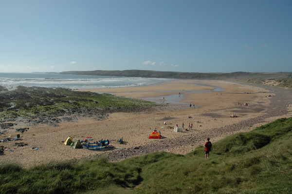
However, there is more to Tenby than beaches and the usual trappings of the holiday resort. The town has a long history dating back to when it was a Norse settlement - the -by ending on the name being a relic from this time. Tenby was seized by the Normans during the Norman Invasion, and a castle was built overlooking the harbour, the remains of which are still visible on Castle Hill. Tenby became a walled town in the 13th century, which came in handy during the Spanish Armada and the English Civil War, two of the most turbulent times in the town's history. Some of the arches in the walls now house quirky little shops, pubs and restaurants. There is a 16th century house near the harbour called the Tudor Merchant's House which is open to visitors and is furnished in the style of the time. Also near the harbour, on Castle Hill, is the Tenby Museum and Art Gallery. During the summer months there are a variety of boat trips available, including crossings to the fascinating Caldey Island - more on this in the next blog post.

The Harbour and beach


Tenby has long had a reputation for being popular with stags and hens, particularly during the summer months, so it can get a bit lively on weekend nights. That said, I have had several very enjoyable short breaks in the town, and I have never witnessed any trouble, just a lot of high spirits, so don't let this put you off visiting this most charming of Welsh seaside resorts.


                                                   Published by kind permission of Tim Baynes Art

Live streaming webcams from various locations.

Map of the area.


Tuesday 23 December 2014

MANORBIER


After the Norman Conquest of England during the 11th century a Norman knight named Odo de Barri received various pieces of land in South Wales as a reward for his efforts during the campaign, one of which was at Manorbier, a few miles from Tenby.  He set about building a wooden  hall surrounded by earthworks on the site.  His son William later improved on his father's endeavours by building a stone castle with a large square tower.  By the end of the 12th century, two high stone curtain walls and a gatehouse had been added.  The De Barri family, who had taken their name from Barry Island which they also owned, and who counted among their number the illustrious priest and author Gerald of Wales, held the castle for over 250 years. It then passed through the hands of a number of successive royal owners.  

The castle saw relatively little action during all of this time, the most dramatic episode having taken place in 1645, when it was seized by Parliamentarians during the English Civil War.  However, most of the castle was derelict by the late 17th century, although what remains today is remarkably intact.  The castle and gardens are open to the public for a large part of the year, and there is holiday accommodation available for rent on the site.  Guests should keep their eyes peeled if venturing outside after dark, when they might catch a glimpse of the castle's resident ghost, a lady in black who has been seen walking purposefully towards the castle entrance before disappearing.

The castle


The castle is surrounded by the charming Manorbier village, with its Norman Church of St James, a contemporary of the castle.  Down below there is a sandy beach served by a car park with an ice cream van during the summer.  The beach is popular with surfers and families alike, although care should be taken due to the strong currents.  The beach is backed by dunes and is crossed by a stream with pebbles containing crinoids and other fossils.  On the headland south of the beach is King's Quoit, a 5,000-year-old burial chamber.

The beach


 Map of the area.


Thursday 18 December 2014

STACKPOLE


In Norman times a fortified manor was established in this part of Pembrokeshire, and the first family to occupy it was the de Stackpole family, hence the name of the present-day Stackpole Estate, a large area encompassing coastline and beaches, small lakes and woodland which is now owned by the National Trust.  The manor house itself has now been demolished, but the rest of the Estate remains.  The most charming part of the Estate is the area known as the Bosherston Lily Ponds, where a series of walks along pathways and over footbridges takes visitors through a nature reserve occupied by waterfowl, waders and otters.  Sadly, the otters proved infuriatingly elusive the day we visited.  The lower part of the reserve opens out onto the wide, sandy beach of Broad Haven, surrounded by rocks and dunes.  The National Trust land extends along the coast to Freshwater East, another sandy beach.  

Bosherston Lily Ponds


Stackpole Quay to the east of the Lily Ponds was built for the dual purpose of shipping out the local limestone and for bringing in fuel for the Estate.  There is a National Trust car park and cafe nearby, and from there the coastal path can be accessed, along which a short walk leads to yet another wonderful beach at Barafundle Bay.  Stackpole Head, meanwhile, is characterised by spectacular limestone cliffs and stacks.  Several of the caves at Stackpole Head have collapsed into blowholes.  There is a lovely 5-mile circular walk taking in the headland as well as Barafundle, Stackpole Quay and the Lily Ponds available by following this link.  

The clifftops to the west of Stackpole Quay


Map of the area.


Wednesday 10 December 2014

ELEGUG STACKS AND ST GOVAN'S CHAPEL


The Elegug Stacks, which lie south-east of Freshwater West, are two enormous limestone pillars rising up from the sea beside the cliffs.  Guillemots flock here in summer to breed, making use of the ledges on the stacks, which they share with other birds such as razorbills, fulmars and auks.  Nearby, to the west, is a natural rock arch known as the Green Bridge of Wales.  There are spectacular walks along the coast to the east, but would-be walkers need to check whether the Castlemartin MOD live firing range, marked by the words 'DANGER AREA' on the Ordnance Survey map, is in use or not before setting off.

St Govan's Chapel is a highly unusual, tiny chapel built into the rocks below the clifftops of this lonely stretch of the Pembrokeshire coast.  There is a car park catering for visitors to the chapel, which is reached by means of a steep flight of steps, making it challenging for the less mobile.  As long as you access the chapel from the car park you will be safe from the Castlemartin live firing activities.  If you feel up to the descent (and subsequent ascent!) of the steps you will be rewarded by the sight of a charming, spiritual relic of the 11th century which, as well as its simple architecture, offers lovely coastal views.  Near the chapel is a rock called Bell Rock, so called because legend has it that pirates stole the chapel's bell, but it was saved by angels who set it in the rock, making the rock reverberate like a bell when struck.

Map of the area.

Link to Castlemartin firing times

File:St Govans' chapel - geograph.org.uk - 876068.jpg
ST Govans' Chapel - geograph.org.uk - 876068. Photo by Anthony Gostling, via Wikimedia Commons.

Thursday 4 December 2014

FRESHWATER WEST


The bay at Freshwater West is blessed with high dunes and a lovely sandy beach, however it comes with a sting.  There are quicksands at low tide at the north end, and there is a strong undertow on the ebb tide, so visitors should exercise caution.  At Little Furzenip, which lies halfway along the beach, there is a small thatched hut, a reminder of the days when seaweed was brought here and stored to be made into a Welsh delicacy called laver bread.

This spectacular bay has caught the attention of Hollywood on more than one occasion.  In May 2009 the beach was taken over by the Harry Potter team, when filming took place for Harry Potter and the Deathly Hallows.  The most striking prop was Dobby's Shell Cottage, which is seen in the film with the dunes as a backdrop.  Then, just one month later in June 2009 the production crew of Ridley Scott's Robin Hood arrived and put on a dazzling display for any casual onlookers as they filmed the scene depicting a battle against French invaders with Robin Hood (Russell Crowe) leading his men into the fray.  The scene was so massive that it involved 800 actors and 130 horses as well as dozens of the boats that were built for the filming.   

Map of the area.   


File:Freshwater West - geograph.org.uk - 239022.jpg
Freshwater West - geograph.org.uk - 239022. Photo by Jeremy Owen, via Wikimedia Commons.

Saturday 29 November 2014

ANGLE


On 9 August 2012 I blogged about a shipwreck off the island of Eriskay which gave rise to a book and film called Whisky Galore, due to the fact that the stricken vessel was loaded with thousands of cases of whisky, making it a magnet for plundering islanders.  It may be a little known fact that Wales has its very own version of Whisky Galore.  In 1894 the Angle lifeboat was called out to Thorn Island, where the schooner Loch Shiel, bound for Adelaide, had run aground with cargo which included a large consignment of 100% proof whisky along with thousands of cases of beer.  Some of the whisky was recovered by customs men, but much of it went 'missing'.  One of the recipients of this boozy haul reportedly died after drinking copious amounts of the whisky. Years after the event, a diver found one of the bottles of beer and, finding it to be still drinkable, decided to sample it.  He subsequently found that had he left it be it would have been worth £1,000,  making it the most expensive beer of his life.  The good news about the Loch Shiel is that the brave lifeboatmen of Angle managed to save the lives of the crew and passengers on board.

The village of Angle lies near the end of a narrow peninsula, and enjoys magnificent views of the Milford Haven waterway - Angle Bay below the village is a great place for people who like watching passing ships.  At the back of the church of St Mary's churchyard is a tiny 15th-century seamen's chapel with stained-glass windows depicting sea scenes.  Behind the church is a fortified tower believed to be Norman.  At the end of the peninsula is West Angle Bay, with a beautiful, clean beach, an ample car park and a recently opened cafe which is getting good reviews.  A short walk from the car park takes you onto the coastal path, from where there are good views of Thorn Island with its Napoleonic fort, built in the 1850s and used for a time as a hotel. In 2011 the fort went up for sale, a snip at £750,000, although the amount that eventually changed hands was significantly lower.  

Map of the area. 


File:Thorn Island Framed.jpg
Thorn Island Framed. Photo by Mike Graham, via Wikimedia Commons.

Monday 24 November 2014

PEMBROKE DOCK


Pembroke Dock was once home to a Royal Naval Dockyard, and there are reminders of that time in the form of the elegant Georgian architecture in the areas around the waterfront.  One example is the Garrison Chapel built in 1834 and originally used as a place of worship, although later incarnations include a theatre and a museum.  The chapel was restored with the help of lottery money, the work being completed in 2006.  Now the chapel houses the Pembroke Dock Heritage Centre, which, among other topics, tells the story of the 'flying boats' which used to be based in Pembroke Dock as well as the history of the dockyard as a whole.  The Centre aims to restore a  Sunderland flying boat; admission is free, though donations are welcomed.  The dockyard built 263 ships for the Royal Navy, including combat vessels and royal yachts, and its closure in 1926 had a devastating effect on the local economy.  Other notable buildings include the two Gun Towers, dating from the mid-19th century, one of which houses the town museum.

During the years 1930-1957 Pembroke Dock housed an RAF base, and was also home to the United Kingdom's largest operational flying boat base.  This made the town a prime target for World War II air raids.  In one attack in 1940 11 oil tanks caught fire, then in 1941 the town found itself in ruins following a series of raids.  Since 1979 Pembroke Dock has been the focal point for more peaceful pursuits, such as providing a ferry service for passengers crossing to Ireland.  Just inland from Pembroke Dock is Pembroke with its castle, occupying a location overlooking the estuary of the Pembroke River, an offshoot from the Cleddau.  The castle, which was restored in Victorian times and stands guard over the town of Pembroke, has seen a lot of action over the years, including an attack by Owain Glyndwr and a siege by Cromwell during the English Civil War.  Next to the castle is the town's main street, which has a mix of mainly Georgian and Victorian architecture.  

Map of the area. 


File:Martello Tower, Pembroke Dock - geograph.org.uk - 726626.jpg
Martello Tower, Pembroke Dock - geograph.org.uk - 726626. Photo by Richard Fensome, via Wikimedia Commons.

Friday 14 November 2014

NEYLAND


In the mid-1880s, due to the exceptionally deep water offshore, the small shipbuilding village of Neyland, on the north bank of the River Cleddau, was chosen by Isambard Kingdom Brunel for a railway terminus and steam packet port for crossings to Ireland and America.  This move was to transform the fortunes of Neyland, bringing not only the railway and the port, but other attendant job creators such as a refrigeration plant which produced ice for packing fish for onward transport, and a wagon works.  A huge pontoon was built for access to the vessels, and a station was installed for the rail passengers, who must have been somewhat confused to be confronted with signs saying 'Milford Haven'.  Further prosperity came from Neyland's role in the sea trade with Ireland, Portugal and Brazil.  However, in 1906 much of the trade was switched to Fishguard.  In 1964 the final nail in Neyland's coffin came with the Beeching cuts, which put paid to the rail link.  

Nowadays, Neyland is known for its excellent marina facilities at the Neyland Yacht Haven.  Neyland is evidently proud of its Brunel associations, and the great man's name lives on in the Brunel Quay on the waterfront.  In 1999 the locals raised £30,000 to pay for a statue of the famous engineer, but in a sad sign of the times the statue was stolen in 2010, probably by metal thieves.  Last year the statue was replaced, so lets hope this one survives.

To the east of Neyland is the Cleddau Bridge, 820 metres long and linking Neyland to Pembroke Dock.  Before the bridge was built there was the choice of a 28-mile journey by road or a ferry service.  The construction of the bridge was marred by delay and tragedy.  The bridge was supposed to open in 1971, but in 1970 disaster struck when four workers died and five were injured due to the collapse of a cantilever.  Construction was halted after the tragedy, and the bridge finally opened in 1975.

Live streaming webcam views from the Neyland Yacht Haven.

Map of the area.

File:Neyland from Pembroke Dock - geograph.org.uk - 1731.jpg
Neyland from Pembroke Dock - geograph.org.uk - 1731. Photo by Penny Mayes, via Wikimedia Commons.

Saturday 8 November 2014

MILFORD HAVEN


The Milford Haven waterway is generally recognised as one of the greatest natural harbours of the world.  Such waterways invariably have a rich history attached to them thanks to their relatively calm, deep waters providing a safe haven for vessels and their occupants, and Milford Haven is no exception.  The Haven's virtues caught the attention of the Vikings as long ago as the 9th century.  In 877 a Viking chieftain called Hubba wintered there with 23 ships and 2,000 warriors.  Later, the waterway proved of great strategic importance to the Normans during their conflicts with the Welsh princes.  During the reign of Henry VIII two forts, East Blockhouse and West Blockhouse, were built to protect the Haven, and these were probably manned during the Spanish Armada and the Civil War.  Then during the Civil War the Royalists built an armed encampment and gun emplacement at Pill near Milford Haven.  

Shakespeare was an early enthusiast of the waterway, declaring: "...how far it is to this same blessed Milford; and, by the way, tell me how Wales was made so happy as t'inherit such a haven."  Later in 1802, Lord Nelson described it as the finest natural harbour in the Northern Hemisphere.  Ironically it was the husband of his mistress Emma, Sir William Hamilton, who bankrolled the building of the town of Milford Haven, with Charles Greville in charge of the planning as the town became a whaling station and a naval dockyard was opened .  The latter closed in 1926, however Milford Haven assumed an important role in the preparations for D-Day, when the docks became part of the US Navy advanced amphibious base.  The LTS (landing ship tanks) were overhauled there and made ready for the Normandy landings.  More recently it was the oil industry that discovered the benefits of the Haven's deep waters, what with the increasing size of oil tankers.  Esso was the first company to open a refinery there in 1960, followed by several others, and between the 1960s and 1980s Milford Haven was one of Europe's biggest oil ports.  Since then there has been a decline, and in fact it was just a few days ago that it was announced that a deal to rescue the Murco refinery had collapsed threatening hundreds of jobs.  

The town of Milford Haven still retains signs of its planned origins, while its growth over the years has led to the surrounding villages of Hubberston, Hakin and Steynton becoming part of the town.  The docks, like so many elsewhere in the country, have undergone a renovation, with a variety of attractions for visitors.  The Milford Haven Museum is housed in the old Custom House and has displays on whaling, fishing and petroleum.  The Waterfront Gallery proclaims itself the largest gallery in Pembrokeshire and showcases the best artists and craft workers in West Wales.  The town also has a marina for the use of leisure craft.  A short distance from the waterfront is the Torch Theatre, which puts on plays and cinema screenings.

Webcam views of the port.

Map of the area.

File:Milford Marina - geograph.org.uk - 891433.jpg
Milford Marina - geograph.org.uk - 891433. Photo by Deborah Tilley, via Wikimedia Commons.

Saturday 1 November 2014

DALE AND ST ISHMAEL'S

The small village of Dale lies on a sheltered bay near St Ann's Head, with local beaches suitable for all kinds of waterborne activities. The oil refineries of Milford Haven can be seen in the distance from the beachfront. The village church, the Church of St James the Great, dates from at least the 13th century. The churchyard contains the remains of countless unknown shipwreck victims, including those who perished during the great storm of 1868. There is an inverted ship's bell on the south wall which was presented to the church by the Navy in 1960; the bell was used as a font in the chapel of nearby HMS Harrier until it closed that year. To the west of the church a path leads to Westdale Bay with a sandy beach and red sandstone cliffs, which is overlooked by the site of a huge Iron Age fort.

Between Dale and St Ishmael's is the Gann Estuary, a treat for birdwatchers with wading birds including little stint, curlew and sandpiper. Otters breed in the reedbeds and there is also the chance to catch sight of a kingfisher in the upper reaches. The area around St Ishmael's has been inhabited since the Stone Age, and there are numerous relics from different points in history since that time, including standing stones, ancient graves and the iron age forts of Great Castle Head and Little Castle Head. The remains of a Norman motte and bailey castle lie on the spot known as St Ishmael's Tump. The village and its church are named after a 6th century Cornish saint who went on to become the Bishop of St David's. A pathway leads from the church to the tiny cove of Monk Haven, where traders and pilgrims used to land on their way to St David's. Another sandy bay in the area is Lindsway Bay, where in 1955 the Queen visited during her Coronation Tour, and Princess Anne and Prince Charles took their first steps on Welsh soil. In August 1973 at nearby Longberry Point the tanker Donna Marika went aground during stormy weather. Some of the local villagers had to be evacuated because the tanker was full of aviation spirit, and there was a risk of an explosion occurring due to the violence of the storm.

Map of the area.

File:Monk Haven - geograph.org.uk - 1023792.jpg
Monk Haven - geograph.org.uk - 1023792. Photo by Robin Lucas, via Wikimedia Commons.

Monday 27 October 2014

MARLOES SANDS AND ST ANN'S HEAD


Marloes Sands can be reached via a 10 minute walk from the car park at the edge of Marloes Village.  The bay here is strewn with the most extraordinary volcanic rocks with layers  that were once horizontal but as a result of past geological upheavals have ended up almost vertical.  The Sands are overlooked at one end by the vertiginous slopes of the small tidal island of Gateholm where archaeologists have found traces of human habitation in the form of rectangular dwellings surrounding a courtyard.  The dwellings, estimated as being from the 6th century, are thought to have been an early Christian monastic settlement.  Marloes Mere, just inland from the beach, is home to wetland birds.   During the 18th century leeches were gathered here for medical use.

St Ann's Head, which dominates the mouth of the vast Milford Haven inlet, is home to a few whitewashed cottages, a coastguard station and a lighthouse.  Approaching the headland via the coastal path from the village of Dale, the path passes a bay called Mill Bay.  This bay assumed great historical significance in the 15th century: in 1485 Henry Tudor, having previously fled to Brittany to begin a 14-year exile, sneaked back into the country at Mill Bay and shortly afterwards defeated Richard III at the Battle of Bosworth, a victory which led to him being crowned King Henry VII of England.

Map of the area.

File:Marloes Sands from the top of the footpath - geograph.org.uk - 658216.jpg
Marloes Sands from the top of the footpath - geograph.org.uk - 658216. Photo by Paul Mercer, via Wikimedia Commons.

Tuesday 21 October 2014

SKOMER ISLAND AND SKOKHOLM ISLAND


Skomer Island and its smaller sister island Skokholm, just off the southern end of St Brides Bay, are important 'Sites of Special Scientific Interest', chiefly for their diverse birdlife and the rich marine environment surrounding them.  Skomer's claim to fame in birding circles is that it houses around half the world's population of Manx Shearwaters.  Also sharing this patch of land are razorbills, guillemots and chough among others.  Added to which there are around 6,000 breeding pairs of puffins, and gull varieties including herring, greater black backed and lesser black backed gulls.  There is limited overnight accommodation from April to September, and the island can be reached on day trips from Martin's Haven on the mainland.

The red sandstone Skokholm Island gets its name from the Norse for 'wooded island'.  In fact, nowadays the vegetation on the island consists mostly of maritime grassland, its growth kept in check by the numerous rabbits living on the island.  It was the Normans who were responsible for this, having built a rabbit farm there in the 14th century.  The rabbits of Skokholm are said to have been the inspiration for Richard Adams' novel Watership Down.  Another interesting fact about Skokholm is that it was here in 1933 that the first ever British bird observatory was founded by Ronald Lockley who, when not scanning the island for interesting birdlife, set about selling the resident bunnies to make money from their skins. Like Skomer, Skokholm is also reachable from Martin's Haven.

Map of the area.

File:South-eastern coast of Skomer - geograph.org.uk - 1434332.jpg
South-eastern coast of Skomer - geograph.org.uk - 1434332. Photo by John Rostron, via Wikimedia Commons.

Wednesday 15 October 2014

THE HAVENS OF ST BRIDES BAY


The southern half of St Bride's Bay is dominated by a string of havens: Nolton Haven, Druidston Haven, Broad Haven, Little Haven, St Bride's Haven and Martin's Haven.   Broad Haven is the largest and most resort-y of them, with a wide sandy beach backed by a small esplanade.  Nolton Haven once earned its living from the coal industry, and there are tunnels running out to sea from the abandoned mines.  Druidston Haven has a magnificent sandy beach, good for surfing, which is reached by means of a path and this, combined with limited parking, has kept it unspoilt, though there is a hotel with a bar and restaurant overlooking the beach.  The cliffs are partly formed from slate, which harbours graptolite fossils.  St Brides Haven is a sandy cove with rock pools overlooked by the Church of St Bride.  The remains of early Christian graves are visible in the cliffs.  Finally, at the southermost tip of the bay is Martin's Haven, where keen birders may spot choughs and other rare species.  Martin's Haven is the departure point for boat trips to the islands of Skokholm and Skomer.

Just round from Broad Haven is the picturesque fishing village of Little Haven, another former coal port.  At low tide it is possible to walk between the two.  I have saved this one until last as Little Haven is home to one of the most haunted pubs in Pembrokeshire which, this being the month of Halloween, merits a mention.  The Castle Inn, formerly the Castle Hotel, is frequented by a variety of ghostly visitors.  The main one is the White Lady, thought to be the ghost of a woman who owned the property in the 18th century.  She died under mysterious circumstances, her body washed up on the beach with head wounds, whether from murder or other means nobody knows.  Other ghostly occurrences in the building include a dark, heavy-set man who materialises in the bar from the feet up, a tall, thin man who appears at the top of the stairs, and an invisible cat which leaps onto people's beds.  Voices have also been heard, along with the sounds of a poker in an open fire, possibly resurrecting fireside chats from the past.

Live streaming webcam view of Broad Haven beach, from Haven Sports.

Map of the area.

File:Little Haven from the path leading to The Point - geograph.org.uk - 236629.jpg
Little Haven from the path leading to The Point - geograph.org.uk - 236629. Photo by Tudor Williams, via Wikimedia Commons.

Tuesday 7 October 2014

NEWGALE


The most salient feature of the south-west corner of Wales is a large, semi-circular bay with Ramsey Island just off the northern end and Skomer Island just off the southern end, giving it a pleasingly symmetrical appearance.  This is St Bride's Bay, and towards its mid-point is Newgale with its 2-mile Blue Flag beach pounded by surf, making it a magnet for surfers, windsurfers and swimmers alike.  The beach is backed by a shingle bank which was thrown up by violent storms in 1859.  During the more recent storms which lashed the country earlier this year, Newgale made the news when the passengers of a bus hit by a giant wave had to be rescued.  Accommodation options at Newgale are dominated by the caravan and camping sites, and there are some shops and a pub.  The west-facing aspect of the beach makes for some fabulous sunsets on sunny summer days.  

On the approach to the bay from the south there is a roadside viewpoint with lovely views of the bay.  Also near this road down to the bay is Roch with its 12th century castle rising up from a rocky outcrop.  Once upon a time Pembrokeshire was divided into two distinct areas, the Welsh area and the English or 'Landsker' area.  Castles such as the one at Roch were built on the borders between these areas for defensive purposes.  During the Civil War in the mid-1600s the castle was passed between the two sides like a parcel, and it fell into neglect after the Civil War, but in 1900 Viscount St David undertook extensive restoration work.  The castle is now an elegant hotel, where in addition to its sumptuous facilities guests may get more than they bargained for in the form of a white-clad figure passing through closed doors.  This is thought to be the ghost of one Lucy Walters, former mistress of Charles II, who was born at the castle and who, with Charles, bore an illegitimate son who would become the Duke of Monmouth, leader of the 1685 Monmouth Rebellion, a role which was to lead to his execution.

Live streaming webcam showing surf conditions at Newgale.

Map of the area.

File:Newgale beach from the cliffs - geograph.org.uk - 1524893.jpg
Newgale beach from the cliffs - geograph.org.uk - 1524893. Photo by Andy F, via Wikimedia Commons.

Thursday 2 October 2014

SOLVA


The main street of the village of Solva leads down to an inlet which has been likened to a mini Norwegian fjord, due to its steep sides and the extent to which it penetrates into this stretch of the Pembrokeshire coastline.  This topography makes for a delightfully sheltered haven for the leisure craft that call in here.  During the 19th century there was a fleet of 30 ships based here, and there were scheduled departures for America from the harbour.  However, the village's last steamship came to an unfortunate end, torpedoed by a U-boat in 1915.  Solva is the kind of place which was beloved by pirates and smugglers, and as was usually the case where these activities were rife, many of the houses had concealed cubby-holes which were used to hide contraband.  Even the local chapel was not immune to being linked to the smuggling trade: its candles were made from tallow smuggled into Solva.  The story goes that the excise officer got wind of this, and confiscated the candles, leaving the congregation fumbling in the dark.  

File:SolvaHarbor(Garethrees).jpg
SolvaHarbor(Garethrees). Photo by Garethrees, via Wikimedia Commons.


Solva is divided into two parts, Upper Solva and Lower Solva.  Lower Solva wends its way through a deep valley, and its main street has a pleasant mix of pubs and shops and leads down to the harbourside, where there is a pub and a cafe.  The village makes an ideal starting point for walks along the Pembrokeshire coast path.  Solva Woollen Mill, on the banks of the River Solfach, was established in 1907 and is still making carpets and rugs.  There is a shop and tea room for visitors, who can also see some of the old mill workings.  

Colourful Lower Solva


Map of the area.


Monday 22 September 2014

ST DAVID'S


Walking down through the centre of St David's, you get the impression of a typical large Welsh village, with a couple of pubs, a small but select range of shops, cafes and restaurants, and rows of rustic cottages.  However, when you reach the end of the main street, the sight that greets you makes it obvious that this is no ordinary village.  In fact, St David's is a city, thanks to the beautiful cathedral nestling in a dip just off the bottom of the main street.  The cathedral dates from the 12th century, and the adjoining ruins of the Bishop's Palace date mainly from the 14th century.  The patron saint of Wales, St David founded a monastery in this spot in the 6th century, and during the Middle Ages St David's became a place of pilgrimage.  Another ecclesiastical site to the south of the city, St Non's Chapel, is reputed to be the birthplace of St David's mother, and it has a healing well.

Aside from the city's religious heritage, the other main draw is the nearby RSPB Reserve of Ramsey Island.  Boat trips to the island can be booked from ticket offices in St David's, and they leave from St Justinian, around a mile from the city.  We went on one of these trips the first time we visited St David's and, although the seals were not on view on that occasion, the knowledgable guide gave a fascinating insight into the abundant birdlife of the island, which includes guillemots, razorbills and kittiwakes.  There are sheep and deer grazing on the island, which provide an ideal habitat for lapwings and other birds.  To the northeast of the city is St David's Head, where there is a Neolithic cromlech and an Iron Age fort, near a stone rampart called The Warrior's Dyke.  The headland was once part of an ancient route linking Pembrokeshire to Salisbury Plain.  For surfers, nearby Whitesands Bay is a good spot.

Map of the area.

Britain's most rural cathedral setting
Ramsay Island


Wednesday 17 September 2014

ABEREIDDY


The people who used to operate Abereiddy's slate quarry, which was closed in 1904 after being flooded by the encroaching sea, might be surprised to find it a hive of activity still, over one hundred years later.  This delightful spot on the south-west coast of Wales is now a pool 100 metres across known as the Blue Lagoon, and is a favourite spot for a range of outdoor activities such as diving, kayaking and the curious sport of 'coasteering', which involves exploring the coast by a combination of climbing the cliffs and plunging into the sea.  Another popular way to enjoy this stretch of coast - and the one favoured by us on our visit - is by walking the coastal path while marvelling at the antics of the coasteerers down below.  In 2013 the lagoon hosted the Red Bull Cliff  Diving World Series. The Blue Lagoon is owned by the National Trust, and the number of visitors flocking there has created some conflict between the operators of the activities and the conservationists, necessitating an agreement on limiting the number of people who can use the lagoon each day.  The village itself consists of a number of colour-washed cottages backing onto a sand and shingle beach made a greyish-black by the slate.  Many of the scenes from a 1961 film starring Peter Cushing were filmed in Abereiddy.  The film, 'Fury at Smugglers' Bay', depicts the ravaging of a small seaside village by pirate wreckers.

Map of the area.

File:Abereiddy, the Blue Lagoon, with 'Coasteers' diving - geograph.org.uk - 1406824.jpg
Abereiddy, the Blue Lagoon, with 'Coasteers' diving - geograph.org.uk - 1406824. Photo by Keith Salvesen, via Wikimedia Commons.

Monday 25 August 2014

PORTHGAIN


You only have to look around you to realise that Porthgain's past was much more industrial than its leisure-oriented present.  The remains of large brick hoppers are still clearly visible, recalling a time in the early 1900s when crushed granite was brought to the village prior to shipment from what was at the time an important industrial port.  40,000 tons of the stuff were shipped yearly by coastal steamers, and the granite-crushing continued until 1932 when the crushing plant was closed.  Slate from a quarry to the south was also shipped out of the harbour.  The hoppers have been left in place as a scheduled ancient monument, in addition to which the village was made a 'conservation area' in 1987.  Prior to this period the main activities were the 'burning' of limestone and fishing, which continues to this day with the local fishing boats sharing the harbour with leisure boats.  The village pub, The Sloop, has a characterful interior with plenty of nautical images and memorabilia and a small terrace overlooking the harbour.  Once upon a time the boatmen were able to moor up right alongside the pub, causing it to be known as the 'Step In'.  Many visitors to the village use it as a starting point for a walk along the wonderful Pembrokeshire Coast Path, aided by a bus service called the Strumble Shuttle which, with careful timing, enables walkers to walk one way and bus the other.  The Porthgain to Abereiddi stretch of the path was once voted one of the top ten walks in the country.

Map of the area.

File:Rusting anchor, Porthgain - geograph.org.uk - 1524078.jpg
Rusting anchor, Porthgain - geograph.org.uk - 1524078. Photo by Pauline Eccles, via Wikimedia Commons.

Sunday 17 August 2014

FISHGUARD


The first thing many people think of when they hear the name Fishguard is the ferry service to Ireland.  In fact, the name of the port the ferry goes from is Goodwick, down the hill from Fishguard town centre.  One word of warning to anyone heading to Goodwick to catch a ferry from the M4 direction: allow plenty of time.  The first time we made the journey we thought we had plenty of time, only to find that the roads became progressively narrower and slower as we neared Fishguard, meaning we almost missed the ferry.

Anyway, back to Fishguard itself.  In 1797 the town was the scene of what is often referred to as the "last invasion of Britain", the invasion in question being on the part of the French, who proved to be unequal to the forces led by Lord Cawdor, otherwise known as John Campbell.  Lord Cawdor used Fishguard's Royal Oak Pub as his Headquarters, and it was here that the French surrender was signed.  The pub has battle memorabilia recalling the event, while the Town Hall houses a tapestry called the Last Invasion Tapestry.  Fishguard is somewhat split into two, with the higher part of town housing most of the shops and galleries including the West Wales Arts Centre, as well as the aforementioned pub, while the Lower Town, laid out around the mouth of the River Gwaun, has the feel of a fishing village.  To the north lie the ruins of the Old Fort, built in 1781; it was from here that guns were fired to warn off the approaching French ships in 1797.    

Map of the area.  


File:Fishguard Harbour.JPG
Fishguard Harbour. Photo by Tim A Lee, via Wikimedia Commons.

Tuesday 12 August 2014

DINAS ISLAND

Dinas Island is not actually an island at all, but a rounded rocky headland between Newport and Fishguard. A walk along the coast path around the headland provides fantastic views of the Pembrokeshire coastline. On the Newport side of the peninsula the path can be joined at Cwm-yr-Eglwys ('Valley of the Church'), named for the ruined church of St Brynach's overlooking the beach. The church, which dates from pre-Norman times, succumbed to the sea twice in the mid-1800s: once in 1850, when the chancel was destroyed, then again during the so-called Royal Charter Storm of 1859 (the Royal Charter was a ship which ran aground on Anglesey during this once-in-a-century storm). The 1859 storm did for most of the rest of the church, so that following demolition work in 1880 there was just one end left standing plus the graveyard. A sea wall was built to protect the site. Walkers wanting to reach Pwllgwaelod, which lies on the Fishguard side of the peninsula, have two choices: stick with the coast path following the peninsula around to Pwllgwaelod, or head inland on a wheelchair-friendly path along a valley which cuts across the landward side of the headland. Pwllgwaelod has a small sand-and-shingle beach with a pub/restaurant which was occasionally visited by Dylan Thomas.

Map of the area.

File:Ruins of St Brynach's, Cwm-yr-Eglwys - geograph.org.uk - 1800572.jpg
Ruins of St Brynach's, Cwm-yr-Eglwys - geograph.org.uk - 1800572. Photo by Richard Law, via Wikimedia Commons.